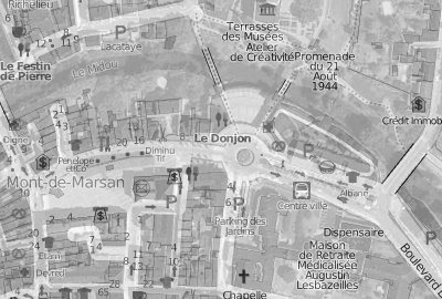
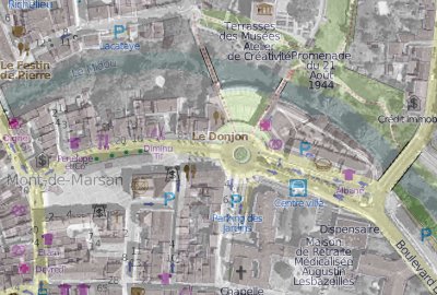
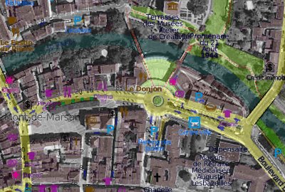
Some weeks ago, I started to refactor landez (timidly). But smart caching and post-processing of WMS maps were expected in my last project, so it gave me a great boost : Landez 2.0 has landed ! :)
The base code is much clearer, and a few new features came out ! Among them, the ability to apply image filters to your maps !
Grayscale conversion
Not the funniest one of course, but quite handy to highlight map content !

from landez import MBTilesBuilder
from landez.filters import GrayScale

overlay = MBTilesBuilder()
overlay.add_filter(GrayScale())
Color to Alpha
If the tiles you overlay are mainly white, they might make your background layer brighter. Therefore, adding a filter replacing white by transparent will nicely blend your top layer without lightening the global result :


from landez import TilesManager, ImageExporter
from landez.filters import ColorToAlpha

overlay = TilesManager(tiles_url='http://an.osm.mirror.org/{z}/{x}/{y}.png')
overlay.add_filter(ColorToAlpha('#ffffff'))

orthophoto = ImageExporter(wms_server='http://server/wms',
                           wms_layers=['orthophoto'])
orthophoto.add_layer(overlay)
Continuous Integration
A Travis job was setup and allows me to improve the testing strictness :)
The Travis configuration has some kind of magic, just drop one file and enable the hook in your Github repo :
language: python
python:
  - 2.6
  - 2.7
install:
  - pip install Pillow
  - python setup.py develop
script:  python -m landez.tests
Next steps...
I hope to get the opportunity to develop new post-processing filters, as pretty as those coming-up in MapBox Tilemill !
PerryGeo wrote python-mbtiles which might be a good candidate for low-level access of MBTiles content. I like the idea of a common python stack for reading and writing, it is not very clear to me which one will emerge as the best one though...
#python, #gis, #landez - Posted in the Dev category